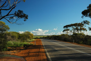
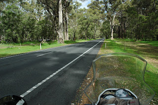
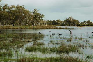
It seems remarkable to me as I tap this out in Streaky Bay on Saturday night (August 28), that after breakfast Thursday week ago, I was saying goodbye to Liz in Broome and heading off for Port Hedland and Perth. I have ridden on 9 of the 10 days since then, averaging 605kms per day. The longest day was 735kms (Coral Bay to Geraldton) and the shortest 347kms (Perth to Margaret River). I have covered a total of 5,446kms since Broome. I have done 16,000kms since leaving Melbourne on Saturday July 17. I have been on the road for 43 days, and on the bike for 34 of them.
I am not a finely tuned athlete but I am feeling much fitter and fresher than I probably deserve to at this point. I attribute it to the wonderful design and engineering of the GS – hundreds of kilometres of bumpy bitumen on some of the less well-maintained sections of road have left me feeling no different than after the same distance on freeway quality roads. That suspension with its variable settings is worth its weight in gold. Also, the riding position puts no weight at all on my arms and wrists (or shoulders), which over 6 weeks is important. The right wrist (the throttle hand) certainly tires more than the left, but the simple throttle lock I installed before leaving allows me to give that hand a rest from time to time, and I am sure this has prevented right wrist issues developing. The new Shoei helmet with its flip-up chin guard, is working very well. It is comfortable, and makes taking photos or having a drink very convenient.
While I am in a rare mood for mere facts, I make he following observations about wildlife as a road hazard. The kangaroo is truly ubiquitous, but appears to die mostly at night. Rabbits must all be on leave, as few have been spotted dead or alive. The emu is not that numerous near roads, but is totally wacky when encountered. The Cassowary is a figment of the imagination of those promoting tourism in the Daintree. The only camels sighted had bright blue and red saddles and were carrying fare paying passengers in a commercial operation in Broome. The wombat is of course nocturnal, and so has not been spotted by me on this ride. Cattle are all over the place, and must be watched carefully. The young ones in particular are skittish and unpredictable. They are all large. Goats were seen in great numbers south of Carnarvon, but appear to have more road sense than most other creatures which make appearances near roads. Road kill presents a particular hazard in the form of the birds feasting on it. As you approach an item of road kill the crow (or raven to be precise) leaves first, then the lesser raptors such as the kitehawk take to the air, and the magnificent wedgetailed eagle is always last to leave. I have got into the habit of braking fully and being prepared to stop unless the eagle clears the road before I get there. They leave late, they leave low and slow, and their flight path is not necessarily a self-preserving heading at right angles to the road. The eagle can fly towards you, or away from the road then back towards you. They seem loathe to give an inch over their possession of the road kill. They would be a bad look on my helmet or chest at speed. And finally, salties. They are everywhere and they will kill you and eat you, whether you are on the road or not. They are the apex predators’ apex predator.
Coral Bay marked the change from being north to being south for me. The ocean water was cool, as was the wind off it. There was a hint of swell in the sea. The morning chill eased as the sun climbed, but only to mid teens, not to the high 20s and low 30s of previous weeks. My jacket liner was needed, as were thicker gloves. I was no longer in the tropics or the sub-tropics. I was south.
 |
| See the black line in the water? That’s coral. That stuff on the beach? That's golden sand, not mud. That Barrier Reef crew should come over here and take a few notes. |
 |
| The elegant little boat ramp at Coral Bay provides access to coral reefs offshore, such as can be seen on the horizon. |
I saw enough of the Ningaloo Reef area and the Shark Bay area to know that I will come back to these places with Liz.
 |
| This dirt road between Normanton and Burketown has stuck in my mind as an archetypal outback dirt road. |
 |
| So after several weeks of variations on the above dirt road theme, it was a refreshing delight as I approached Geraldton to see green pasture, good bitumen, plenty of natural growth and evidence of moisture in the skies. |
 |
| Do not select your motel after dark. |
The Pilbara saw the land being tortured to yield up its bounty. Between Geraldton and Perth the earth yielded gentler and more aesthetically pleasing riches.
 |
| Jurien Bay was a pleasant surprise. It was there I met Karl, Jacqueline and David – see you all in Stuttgart. |
A most pleasant few days were spent in Perth with Catherine, Martin and their girls Hannah and Isabelle (and Elly). Thanks for the great hospitality.
The new left pannier was available in Perth and was fitted to the bike. The back tyre was replaced and I expect the front tyre will need replacing in Adelaide. The GS also received its well-earned 60,000km service, and my replacement GPS was wired into the bike. When I left Perth on Tuesday morning the bike was once again in excellent repair and the engine was purring.
Driving through the Margaret River area was like driving through parkland. Knee-deep green pasture, magnificent eucalypt stands, and Arum Lilies growing wild at every turn. What a contrast to the harsh environments of the last few weeks.
 |
| The only stretch of road between Bunbury and Augusta where a winery or part of a winery was not actually visible. |
 |
| This is where the spares are kept for the WA emblem. |
Storms were approaching from the west as I rode down the west coast south of Perth, giving dramatic backdrop to the shores of the Indian Ocean.
 |
| South of Yallingup there was an abundance of west-facing bays like this one. |
In music, a grace note is a note which does not contribute directly to the melody or harmony, but is a short almost insignificant note which nonetheless adds beauty to the whole. It would not surprise me to learn that Gracetown just north of Margaret River was named by someone with this in mind. A handful of houses nestled on red soil overlooking an emerald bay, with the powerful Indian Ocean swells arriving with unabated momentum from half a world away.
 |
| Gracetown |
The tranquility of Gracetown was shattered last week when a lone surfer was killed by a shark at a popular point break.
 |
The shark attack occurred in the waves to the right of the point just visible to the left of the vertical post in the photo above. Nick was a father, husband, son and brother.
The notice, pinned up a couple of days after the attack, urges surfers to go out and get a really great wave to honour the spirit of the surfer who died. When I was there they were doing just that in droves.
There was a solid overhead surf pumping when I stood on this lookout, and there were a dozen or more surfers off the point revelling in the conditions.
Every surfer knows the risk, and willingly takes it. It will always be so.
|
 |
| I stopped the motorbike deep in this forest, and just sat for a while. It was early morning, moist and cool. If you have never breathed deeply in a eucalypt forest in the early morning, I suggest you make arrangements immediately to do so. |
 |
| Margaret River is full of rather twee guest houses and B&Bs. I believe however that some of them are really comfortable. I spotted the bike above which is somewhat like mine, in such a place. I of course camped that night on a rocky headland with salt spray hitting my tent as the relentless cold westerly winds blew low scud across the cold sliver of a new moon and chilled me to the bone. Or did I just dream that in my king sized bed in a twee B&B with the electric blanket on 8......? |
I came across a few roos on the outskirts of Margaret River.
 |
| “As a matter of fact I do pump iron. Why do you ask?” |
 |
| “On your marks, get set.....just kidding. Do you like the profile?” |
 |
| “Hey, watch this! Wanna see a handstand?” |
He was still performing as I rode off.
Footnote for those unfamiliar with the literary device of ascribing words to creatures which speak very little or no English (and you know who you are): the kangaroo in question did not in fact say any of the above things. I made them up.
 |
The Indian Ocean west of Cape Leeuwin, on the very SW tip of Australia.
This is a wild place.
|
I made the last of my three left turns on this ride at Cape Leeuwin. I am now done with north, west and south. Easterly headings will see me in Apollo Bay by Friday of next week. This is a week earlier than originally planned, but the trip ends when it ends. I have no agents importuning me to arrive home at a time convenient to the press, the prime minister (whoever that might be) and a welcoming throng. Welcoming family and pug crosses will do me nicely.
I will ride to Port Lincoln tomorrow, and possibly beyond. I plan to be in Adelaide by Monday night or Tuesday morning. I will leave Adelaide on Wednesday with company at last – Kym is going to ride out of Adelaide with me for a distance yet to be decided. Regrettably, my brother Noel could not join me in Ceduna, which is as big a disappointment to him as it is to me. He will join me however in Victoria somewhere west of Apollo Bay.
 |
| The Starburst Palm. |
 |
They do have some big karris in the southwest. In Victoria, such a sight would be marred by signs saying ‘Trees near edge of road.’ I kid you not, such signs exist.
In WA, the trees are left to convey this message all on their own.
|
.JPG) |
| Some parts of riding around Australia on a motorbike are less fun than others. |
 |
| Rainwater puddle deep in the karri forest in SW Western Australia. |
 |
| Saltbush plains near the Nullarbor. I feel dutybound to report that on the Nullarbor, the arbors number a little more than null. But generally, it is a flat treeless plain as advertised. |
 |
| Border Village, yesterday evening. |
 |
| I woke at Border Village to find frost on my bike, a heavy fog, and 1-2 degrees C. The fog was particularly thick at the border, but looking straight up I could see that it was not very deep, and there were already areas of white glow where the sun was making inroads so I headed off expecting it to burn off pretty quickly. If I was in an aircraft, I would certainly have started up and taxied out in expectation of having enough visibility for a takeoff. |
My first few kms along the Eyre Highway in fog were pretty slow. As the fog started to thin, I got a few sightings of the coastal cliffs with sloping ground above them, and the great Southern Ocean below. At one spot there were white tendrils of fog flowing in slow motion down the low points in the sloping ground and spilling over the cliffs into the sea.
 |
| The fog did burn off quickly to reveal a sparkling blue morning. When I got glimpses of the water off the cliffs in the Bight, there was a sizeable glassy swell rolling in. |
 |
| This is a web which can be seen from outer space, and which only traps the occasional blind insect which stumbles into it. The web is the handiwork of the generally unhappy looking Nullarbor Slim Spider. |
 |
| The last time I visited Nullarbor Roadhouse it was with Lizzie in a Cessna a bit like this one, only faster (a Cessna 182RG). |
A few kms past Nullarbor Roadhouse is a turn off the Eyre Highway to the Head of the Bight. For many years Southern Right Whales have used the waters close to the cliffs here during the winter months as a nursery.
You really had to be there. There was no room on the bike for a telephoto lens unfortunately.
Remarkably, near the cliff-tops where these photos were taken is an official little hut which is the only access to the track to see the whales, inside which adults get charged $12. I inquired politely before paying as to the exact nature of the value added to the whale watching experience by such payment. I was told that it funded the hut. I suggested that the hut added very little if anything to the experience of looking out to sea at whales. Then I remembered that I am a peaceful person and not a troublemaker, and bade him good day and moved on smiling and whistling (alternating of course, as I can’t do both at once) to my hut-enhanced whale-watching experience.
 |
| At Penong on the west coast of South Australia, they tap the water in the artesian basin with great gusto. |
 |
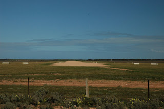
| This is one of the runways at Ceduna Airport. |
I took this photo because when I lived in South Australia I landed on this airport many times. I have landed here in dust storms, driving rain, strong winds, thunderstorms, and at night with kerosene flares lined up down both sides of the runway. Fortunately, such events were all on different occasions.
The groundsman at the airport back in the late 1970s was a young fellow with a family, who used to get overtime if he had to put out the kero flares for a night landing. So on my fortnightly flying trip to Yalata (west of Ceduna) I would defer my departure from Yalata to dusk to ensure a night landing at Ceduna, which kept me current at night flying, and the groundsman with a bit of overtime pay. He generally gave me a lift into town to my motel after he had collected the flares and stacked them away.
On one occasion I landed here with two student pilots in a C172 and the wind was blowing 40 knots right up the strip in the photo above. There was a flight service unit at the airport, and they informed us by radio that 40 knots was the steady wind strength – no gusts, just 40 knots. The sky was blue.
We landed and stopped short of the first taxiway to the right in the above photo (just before the three white cone markers on the edge of the strip), and were faced with the dilemma of taxying with a 40 kt side wind. An aircraft on the ground in such a situation gets much more lift from the wing into wind than from the partially shielded wing on the downwind side of the aircraft. Net result, the aircraft wants to flip. My two student pilots were rather large lads off the land, and they exited the aircraft while it was still pointing into wind. One got hold of the wing tip, and the other leant his considerable mass over the left wing strut. I then taxied at less than normal walking pace to the square of bitumen outside the flight service office, and parked into wind. That square was no more than 30 or 40 paces wide.
For departure, I deemed the crosswind taxying option more hazardous than taking off directly into wind straight across the bit of tarmac outside the flight safety office which was for parking only. So the three of us climbed aboard. The airspeed indicator was showing 40 knots before I had started the engine. I fired up the engine, applied full power and we were airborne before the edge of the tarmac. I never heard any more about that takeoff.
Streaky Bay. Delightfully peaceful. As the wind died late this afternoon, the cloud cover moved to the east allowing the setting sun to put on yet another show.
 |
| This photo was taken half a dozen paces from the front of my unit. |
 |
| As the tide receded, I walked out into the bay with the pelicans. |
My favourite feathered aviators and I were standing in two inches of water for these photos.
The seagull in this final photo had a most curious technique for locating food in the wet sand. He would literally run up and down on the spot, his webbed feet making a clicking sound as he pounded them up and down on the wet sand. He would then stop and pick up whatever food it was that was that unwisely popped its head out of the sand to see what was going on.
 |
| Sunset in Streaky Bay, South Australia, on Saturday 28 August 2010. |
A feeling of contentment is unavoidable in this place at this time.


.JPG)
.JPG)


.jpg)


.JPG)


